Wednesday, March 2, 2022

Measuring Mt Fuji

How Japan’s highest mountain came by its altitude of 3,776 metres

“Mt Fuji is in the province of Suruga: its peak is sculpted as if by a sword-blade, soaring up until it touches the sky,” wrote Miyako no Yoshika (834–879) in the Honchō-monzui, a Heian-era literary compendium, adding that “its height is not to be measured.”

Survey marker on Mt Fuji's crater rim, c.1901
Illustration from Fuji-Annai by Nonaka Itaru (Heibonsha edition)

That was probably good advice at the time, given the wild inaccuracy of early attempts to guess the mountain’s stature. The author of Ise Monogatari, for instance, put it at ten times the height of Kyoto’s Mt Hiei (848m) – or twenty times, these translators say – thus lifting Mt Fuji into the league of the Himalaya’s tallest giants.

Fast-forwarding a few centuries, the savants started to feel the need for more precision. A solid attempt at fixing Mt Fuji’s altitude was made in 1727 by Fukuda Riken. Applying a trigonometrical method from the vicinity of Yoshiwarajuku in what is now Shizuoka Prefecture, he calculated a height of 35.62 chō, equivalent to 3,895 metres, 

Eighteenth-century surveying techniques

Then there was Inō Tadataka (1745–1818), who from the turn of the nineteenth century spent the last seventeen years of his life mapping the whole of Japan – at his own expense. In the process, he made trigonometrical measurements from at least four locations around Mt Fuji’s foot. These resulted in a somewhat scattergun set of estimates. But the altitude he settled on for his map was equivalent to 3,927.7 metres, no more than about 4% off the mark.

Soon devices for gauging air pressure arrived, giving the savants a new way to measure Mt Fuji. The first to deploy such a barometric method was the doctor Ninomiya Keisaku (1804–1862), a colleague or student of Philipp von Siebold (1796–1866). Although it is not known exactly which technique he used, he came up with a height of 3,794.5 metres, extraordinarily close to the modern surveyed altitude. This was in 1828.

In 1860, Rutherford Alcock, her Britannic Majesty’s Minister Plenipotentiary to Japan, became the first foreigner to climb Mt Fuji, together with his dog, Toby. Alcock’s aims during this excursion were mainly political, but as befitted a diplomat who had once trained as a surgeon, he encouraged scientific and botanical observations.

Thus it was that one Lieutenant Robinson came to boil up his thermometer on the summit. Deducing an altitude of 14,177 feet, the naval officer inadvertently promoted Mt Fuji into the ranks of the four-thousand-metre peaks. It is possible that the typhoon which assailed the party soon afterwards might have reduced the air pressure, leading this hypsometrical technique to exaggerate the real height.

More ambitious in his scientific aims was the geographer Ferdinand von Richthofen (1833-1905) – the Red Baron’s uncle – who climbed the mountain in 1870 with Gottfried Wagener (1831-1892). They’d hoped to establish the base point for a magnetic survey, but a lack of preparation prevented them from carrying out their plans. They would not be the last to experience the peculiar challenges of surveying from the top of Japan’s highest mountain.

Rutherford Alcock's ascent of Fusiyama

A decade later, in August 1880, it was the turn of engineering student-turned-meteorologist Wada Yūji to measure air pressure on Mt Fuji - he took readings at the base while a colleague simultaneously did the same on the summit. At the same time, his professor, the scientist Thomas Mendenhall, spent several days on the summit in order to weigh the earth. Later, “Meteorologist Wada” was to win fame first as the patron and then as the rescuer of Nonaka Itaru and his wife Chiyoko, who spent 82 days on Mt Fuji in the winter of 1895 to take weather measurements. So it was that humble data collection broke the trail for Mt Fuji’s transformation into a Meizan of science. 

Japan’s first official mapmakers – the surveyors of the Army’s general staff – were well aware of the difficulties involved in measuring Mt Fuji. Slant ranges would be hard to measure accurately, owing to the summit’s height above surrounding triangulation points. And this was to say nothing of the problems of coordinating teams of surveyors over such distances. So, wisely no doubt, the government surveyors left Mt Fuji’s summit out of their first network of primary triangulation points, which they laid out in mid-Meiji times.

Of course, the mapmakers couldn’t ignore the summit altogether. So in 1885, they placed a fourth-class triangulation point on Hakusan-dake, a peaklet on the crater rim. From this, the surveyors calculated an altitude of 3,753.4 metres. Then, using a levelling technique (or flat-plate survey), they extrapolated the height of Ken-ga-mine, Mt Fuji’s highest eminence, as 3,778 metres. For more than a generation, this would be the universally accepted height of the mountain.

Triangulation point on Ken-ga-mine
(Photo by courtesy of Nippon no Sokuryoshi)
In 1926, the surveyors went back to Mt Fuji, as part of the government’s initiatives to revive the economy after the Great Kanto Earthquake. This time, they put two new second-class triangulation points on the crater rim, one on Hakusan-dake and another on Ken-ga-mine, the highest point. Two were needed because no single location could be seen from all directions. From the Hakusan triangulation point, the surveyors used the altitude angle measurement method to establish an altitude of 3,776.29 metres for Ken-ga-mine. And this, omitting the decimal fractions, is the source of the summit spot height marked on all current maps of Mt Fuji.

Alas, it is no longer possible to revisit the exact locus of this historical altitude determination. After a decade or so, the rocks around the Ken-ga-mine marker crumbled away, exposing its base. Indeed, the triangulation point itself is rumoured to have tumbled down into the crater below. So, in 1962, the concrete base was rebuilt and the marker adjusted to a height of 3,775.6 metres, or 3,776 metres in round numbers. Erosion also undermined the Hakusan-dake trig point, which also had to be repaired.

Not everybody got swiftly behind the new official altitude. As late as 1943, Dazai Osamu, a literary type, was still referring, in his One Hundred Views of Fuji, to "the three-thousand, seven hundred and seventy-eight-metre mountain…”. Or perhaps the novelist was ahead of the curve. In 2002, Japan’s Geospatial Information Authority of Japan installed the first “electronic reference point” on Ken-ga-mine, giving an altitude of 3777.5 metres.

However, the GIS notes, “this will not change the commonly accepted elevation of 3776 metres.”

References

Uenishi Katsuya, Nippon no sokuryōshi (日本の測量史) website, Surveying Mt Fuji (富士山の測量).

Kamogawa Masashi, “The Mount Fuji Research Station: A Scientific Treasure Trove”, nippon.com

The Nonaka Itaru & Chiyoko Digital Archives (野中 至(到)・千代子資料館), chronology (年 表) for Wada Yūji’s surveying work with Mendenhall in 1880.

Geospatial Information Authority of Japan, Establishment of an electronic reference point on Mt Fuji (富士山に電子基準点設置 -わが国で最も高いところにある基準点).


Monday, February 21, 2022

Images and ink (45)


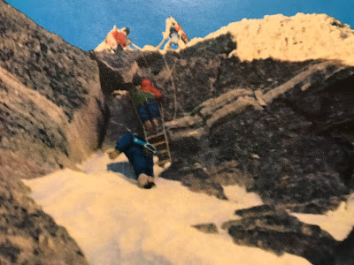
 Image: Excursionists on the Rochefort Arete (Photo courtesy of Alpine Light & Structure). 

Ink: From Mountains with a Difference (1951), by Geoffrey Winthrop Young.

Most mountains have personality. Some of course, like some acquaintances, are forgotten as soon as we have parted from them. But a number I found to possess an individual character, which became the more pronounced and the more attractive, the more often I visited them. These mountains became in all seriousness, friends. I hailed them from afar each year with the glow which greets old friends returning, and every fresh contact discovered new aspects in a well-loved personality. I was happy just to be upon them, to talk with them wordlessly as I climbed through the intimate silence we share only with a friend. If I slept out under their shadow, it was with the confidence we feel at home, where all the outer universe of stars and darkness looks in upon our security with kindness.

The Apennines, I noticed when I lived among them, had this human personality for the artists of the Renaissance. The circle of Florentine hills framed sympathetically, for them, a small domesticated universe, in which all the hierarchy of heaven floated in the most companionable of immortalities. My universe was perhaps a little larger; but the bigger mountains surrounding it had with me the same personal relationship. They were the guardian pillars set about a like kindly earth; and if not within them as at Florence, yet among them and beyond them there lay for me more than a little of the divine. So it may be said that to the Weisshorn or to the Grepon I could return as to a paradise regained. There was no time and no freedom left me, after the war years, to make new mountain friends; there was too little even to revisit all the best of the old.

Once one of them revisited me on its own account, an unusual experience. It was in the invalid years after the war, and I was working in Geneva with Henry Nevinson, most chivalrous of writers and of war colleagues. He had taken me to dine at one of his secret high places, where the view and the food were both, he declared, incomparable. The view at the moment was covered with evening mists; so we sat outside and talked of the mountains, one of his lifelong enthusiasms. I was thinking, as we spoke, how far the great Alps were now removed from me by my handicap; and I looked across, and saw that the view had cleared over all the mountain ranges beyond the Lake, as far as Mont Blanc.

And then, unbelievably clear and near, a great mountain came out of the brightening sky towards us, every feature of glacier and buttress thrown into salience by the level western sunlight now falling upon it. By every map measurement it was whole leagues away, where I had last left it at the far end of the Mer de Glace. And yet, it was undoubtedly the Grandes Jorasses, a very old friend; and the shoulder which it was conspicuously thrusting forward into my sight was the castle on the summit-ridge to which, since I had seen it, my own name had been given. Nevinson shared to the full in the pleasure of the surprise; and indeed the astonishing nearness and brilliance of the mountain's approach had something of the friendly shock with which we see a familiar face smiling at us out of a crowd of strangers in a foreign land.

Sunday, February 13, 2022

From dearth to diversity

International blogs about Japan’s mountains come roaring back

A while back, we riffed on the sudden dearth of Japan mountain blogs – at least, in English. Their number seemed to be dwindling by the day. Worse, some commentators were doubting whether blogs would survive at all, as folk ditched them for tweets and other forms of insta-gratification.

Posts for practitioners - the Japan mountain blogging scene
(Photo: Kurobe Shimo-no-Roka, September)

So it’s good to see that, over in Tokyo, Bre’er David has kicked these doubts definitively into touch. On his Ridgelines blog, he recently highlighted no fewer than sixteen Japan mountain blogs (kindly including this one), all in English.

Moreover, this blogoverse seems more diverse than ever: three are written by women, and on a rough count, the authors seem to come from at least five or six different countries.

But maybe we should make that seventeen blogs. We recently happened across Meizan Memories, a well-organised and illustrated blog recording trips to many of the Hyakumeizan or the 200- and 300-summit listings.

Written by Tokyo-based Ben Hentschel mainly in his native German, but sometimes in English, Meizan Memories is a resource for practitioners. If you want to see what your chosen mountain will look when you get there, and how best to approach it, this blog should help. 

Wilkommen an bord, Ben.

Wednesday, January 12, 2022

Images and ink (44)


Image: Alpinist N. on the Wellenkuppe (Photo courtesy of Alpine Light & Structure). 

Ink: From Mountains with a Difference (1951), by Geoffrey Winthrop Young.

But whom does not the alchemy of mountaineering melt into his essential gold?- whenever there is gold in him. There have been cases, I know, to show that a man may climb, and climb and prove a villain. But he will have climbed from vanity in his own prowess, and not from love of mountains, and the truth in him will soon out. Even in those first years, when it as still easy to know, or know the name and the performance of everyone climbing in our country, here and there appeared those whom I called the 'three year' men, men who flashed into climbing for its sensation and its acrobatics, and from vanity. They soon exhausted the sensation; sometimes they killed themselves; and in any case they disappeared once more from our ken. But the majority of those who were first drawn to the hills and their novel adventure were men of character and often of outstanding ability. These men, tested as comrades by mountain danger, difficulty and fatigue built our great mountaineering tradition.

Tuesday, January 4, 2022

Hot start

Elevated temperatures on the first ski-tour of the year

Freiberg Kärpf in the Swiss canton of Glarus was an easy choice for the year’s first ski-tour. The mountain usually has enough snow. By bus and train, it lies only two hours or so from Project Hyakumeizan’s front door. And, as a “Hausberg” of Elm, the homely alpine village at its foot, Kärpf almost qualifies as a local Meizan.


On New Year’s morning, the scenery looked as it should – a ring of snowy mountains stockading the head of the Sernftal. Only the spring-like warmth seemed to strike the wrong note.

A news screen in the train had alerted us to the near-record temperatures. At the year-end’s midnight, it said, the freezing level had risen to 3,764 metres – a height exactly equal to Mt Cook’s in New Zealand (before the top fell off) and not much lower than the Eiger’s. You’d normally expect it to be freezing in the valley at this time of year.


There was an alpine guide of the past who habitually refused to leave the hut if the temperature rose above zero – and this was on a summer night. Today, he’d no longer be in business. Yet his judgment was sound. A warm breeze brings out the worst in the mountains, from weaker snow bridges to increased rockfall.

Skiing up through the woods, still in shadow, there was time to think through the risk factors. Kärpf has no glaciers and any loose rocks would probably hold their peace. Paradoxically, the warm night’s most serious effect would most likely be a hard-frozen snowpack – thanks to the sorcery of radiation cooling, which can chill the snow overnight even when the air temperature is well above zero.


And so it proved. In the mountain’s shadow, the icy glaze made for some tense moments on the steeper traverses. Such places recalled some recent accidents, where ski-mountaineers had fallen to their deaths from peaks traditionally thought to be harmless.

Long flutings corrugated the slopes. In the slanting winter sunlight, they were as graceful to behold as they were untractable to ski across. It was hard to believe that these were rainwater runnels – at 2,600 metres in midwinter. But, then again, rainfall was recorded last summer for the first time ever at the top of Greenland’s ice cap, at 3,200 metres. So why should we be surprised by midwinter rains at this southerly latitude?


Freiberg Kärpf is famous for its ibex, chamois, deer and other wildlife. Some say it is “the oldest game reserve in Europe”. If so, this is due to one Joachim Bäldi. In 1548, seeing that the wild animals were being hunted to extinction, the chief magistrate had the mountain set aside as a wildlife sanctuary, a status it retains to this day. I wish I could find out more about this far-sighted Landamann. You know, we could use some administrators like that today …

Friday, December 31, 2021

The Matterhorn sways

Why John Ruskin might have welcomed the latest research

For those who see mountains as dynamic creations rather than dead matter, confirmation has just come in from the savants. A team of German, Swiss and American researchers has discovered that the Matterhorn sways – or resonates – about once every two seconds.

The Matterhorn from the moat of the Riffelhorn, by John Ruskin
Image courtesy of the Ruskin Collection, Museum of Sheffield

Seismometers hooked up near its summit, flank and foot showed that the Matterhorn oscillates in both a north-south and in an east-west direction, each at a frequency of 0.42 Hertz. The energy for these vibrations comes from earthquakes and tidal movements. They move the Matterhorn’s summit – albeit by microscopic amounts – more than they do its base.

For a more detailed account of the research, see the excellent write-up in the Daily Mail – always quick to spot a good celeb story – or, if you prefer a more scholarly rendition, the one published by Switzerland’s Institute for Snow and Avalanche Research. Don’t forget to listen to the sound recordings, amped up for human hearing.

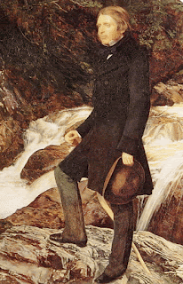
Ruskin by Millais
News that the Matterhorn sings in its sleep probably wouldn’t have fazed John Ruskin (1819-1900). Although best known as an art critic and promoter of mountain scenery, he once said that if his parents had allowed him more freedom he would have become “probably the first geologist of my time in Europe”.

Be that as it may, the great critic had an intuitive sense of stone. Take his extraordinary riff on “slaty crystallines”, the gneiss-type rocks that for the most part make up the Matterhorn. In tracing their wavy structure to some "strange quivering of their substance", he seems almost to have anticipated the latest research:

We yield ourselves to the impression of their eternal, unconquerable stubbornness of strength; their mass seems the least yielding, least to be softened, or in anywise dealt with by external force, of all earthly substance.

And, behold, as we look farther into it, it is all touched and troubled, like waves by a summer breeze; rippled, far more delicately than seas or lakes are rippled: they only undulate along their surfaces—this rock trembles through its every fibre, like the chords of an Eolian harp—like the stillest air of spring with the echoes of a child’s voice. Into the heart of all those great mountains, through every tossing of their boundless crests, and deep beneath all their unfathomable defiles, flows that strange quivering of their substance. …

They .[the mountains] … are yet, also ordained to bear upon them the symbol of a perpetual Fear: the tremor which fades from the soft lake and gliding river is sealed, to all eternity, upon the rock; and while things that pass visibly from birth to death may sometimes forget their feebleness, the mountains are made to possess a perpetual memorial of their infancy,—that infancy which the prophet saw in his vision: “… I beheld the mountains, and lo, they trembled; and all the hills moved lightly.”

Fragment of the Alps, by John Ruskin
Courtesy of the Havart Art Museum, Cambridge MA

References

Samuel Weber, Jan Beutel, Mauro Häusler, Paul Geimer, Donat Fäh, Jeff Moore, “Spectral amplification of ground motion linked to resonance of large-scale mountain landforms”, Earth and Planetary Science Letters, 2021, doi: 10.1016/j.epsl.2021.117295

John Ruskin, Modern Painters, Vol IV, Chapter IX, “Of the materials of mountains: secondly, slaty crystallines"

Friday, December 24, 2021

Motivations of the Maoist mountaineers

On May 27, 1975, nine Chinese mountaineers successfully ascended the world's highest peak, Qomolangma Feng (Mount Jolmo Lungma), from its north slope, thanks to the loving care and attention of Chairman Mao and the Central Committee of the Chinese Communist Party and to the wholehearted support of the people throughout the country....


 … Their remarkable feat in the conquest of nature, the second of its kind accomplished by Chinese mountaineers, was a triumph of Chairman Mao's proletarian revolutionary line, another creditable achievement of the Great Proletarian Cultural Revolution and the movement to criticize Lin Piao and Confucius.


Thus begins Another Ascent of the World’s Highest Peak: Qomolangma, published by Peking’s Foreign Languages Press soon after the event. This was the second Chinese expedition to the mountain that some recidivist elements still call Everest. The first one in 1960 had completed the north ridge route to the summit, as originally prospected by the British expeditions of the 1920s.

The 1975 expedition was notable for the participation of 36 women climbers and support members, of whom one reached the top. This triumph is set out in a carefully worded paragraph:

The fact that during the Chinese expedition, a woman climber reached the summit of Qomolangma from the north side for the first time in world history, serves as a convincing proof of the great truth pointed out by Chairman Mao: "Times have changed, and today men and women are equal. Whatever men comrades can accomplish, women comrades can too."

The summiteer mentioned above was Phantog (right), who was born as “daughter of a serf” in Tibet. When selected for training as a mountaineer – this was in 1959 – she was working for the “July First” State Farm in Lhasa.

Phantog very nearly became the first woman to summit Everest from any side – except that Japan’s Tabei Junko had pipped her to the post just 11 days earlier, reaching the summit via the southern route. But this was a disappointment that the anonymous authors of the Foreign Language Press book could not bring themselves to mention explicitly.

The book’s illustrations reveal much of the motivations that China’s mountaineers were obliged to profess during the last years of Chairman Mao’s tenure. The words in italics are the original English-language photo captions: 


Source of strength, guarantee for victory. Earnestly studying Chairman Mao's works they enhance their consciousness of the necessity of continuing the revolution and strengthen their determination to conquer the world's highest peak.


"Never forget bitter class oppression, firmly remember the blood and tears of the down-trodden!" A visit to an exhibition on class education in Lhasa, exposing the brutal oppression of the Tibetan people by the serf-owners, arouses burning hatred for the old society and strong love of the new in the minds of the mountaineers.


Study hard to combat and prevent revisionism and consolidate the dictatorship of the proletariat. Secretary of the Party Committee of the Expedition Wang Fu-chou (second right), one of the three that reached the summit of Qomolangma for the first time ever from the north slope in 1960, and mountaineers at the 6,000-m. camp, study the theory of the dictatorship of the proletariat to fortify their revolutionary will in scaling the world's highest peak.


Nothing can stop the advance of the mountaineering heroes armed with Mao Tsetung Thought. Here, they are seen struggling up a snowy slope at 7,400 m. in the teeth of ferocious altitude winds.


Women alpinists write big-character posters to criticize the reactionary fallacy preached by Lin Piao and Confucius, that "man is superior to woman," and to pledge their determination to win honour for socialist China by a successful climb of Qomolangma.


A new member is admitted into the Communist Party at the 8,200-m. camp.


Instantly Base Camp becomes alive with joy and excitement, shouts of "Long live Chairman Mao!" and "Long live the Chinese Communist Party!" echo through the valleys.

There is a coda to this expedition. Four years after their respective Everest ascents, Phantog met Tabei Junko at a climbers’ meet in Chamonix, where they were photographed together with Poland’s Wanda Rutkiewicz, the third woman to summit Qomolangma. The full story is told by Alison Osius, herself a climber of renown.

Photo by courtesy of Isabelle Agresti/Climbing

Phantog and Tabei were coevals, both born in 1939. Both combined full-time jobs with climbing, marriage and motherhood – Phantog had three children, and Tabei two. Each was a member of her country’s mountaineering elite. One wonders if they had a language in common and, if so, what they talked about at that long-ago encounter in Chamonix …

References


Another Ascent of the World's Highest Peak: Qomolangma
, Foreign Languages Press, Peking, 1975.

Alison Osius, The First Three Women to Climb Everest, Climbing online, March 2021.